 Detailed Trail Review: Dittmer-Watts Nature Trail Park (formerly called Donald Ross Nature Trail Park)
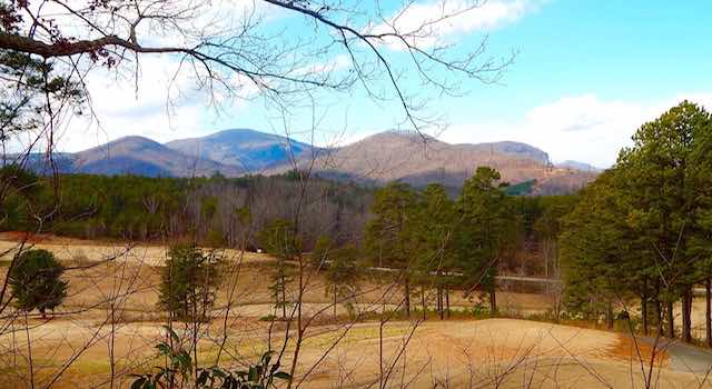
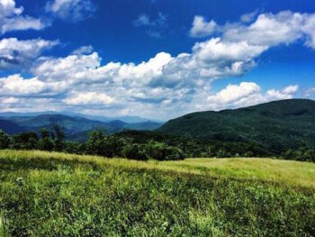
Highlights: As the name implies, Dittmer-Watts Nature Trail Park is surrounded by nature. It has very well maintained trails and two big, open fields where you can let your dogs run. There are also nice views overlooking the Lake Lure Municipal Golf Course and up the Hickory Nut Gorge area. You will also find numerous picnic tables and a picnic pavilion area where you can eat a packed lunch and enjoy the day.
Location: Dittmer-Watts Nature Trail Park – 271 N. Carolina 9, Lake Lure, NC 28746
Approximate Driving Time from Lake Lure Town Center: 10 minutes
Map & Directions: From the Lake Lure Beach, head east on Memorial Hwy. (64E) for 3.3 miles. At Larkin’s Restaurant, veer right onto NC-9. The Park is at the top of the hill on the left – across from Ingle’s Supermarket.
 Dittmer Watts Nature Trail Details:
Hiking Distance (round trip): All trails combine to create approximately 3 miles – but with all the cut-through trails, your hike can be as long or short as you wish.
Hiking Time: 15 minutes to 2 hours based on the route you take
Elevation Gain: Approximately 150 ft.
Difficulty: Easy to Moderate
Trail Condition Grade: A
- A = Park like
- B = Easily Identified, Good Footing
- C = Easily Identified, Bad Footing in Some Places
- D = Difficult to Identify, Bad Footing
Trail Challenges: There are 3 steep down and ups that can get slippery with rainfall or leaves. The dogs love them but 2 legged hikers need to take it slow.
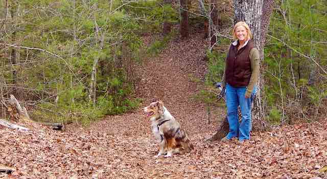 Dog-Friendly: Absolutely – you don’t need to keep your dogs on leash. You do need to maintain control of your dogs – it’s called common courtesy. Another aspect of common courtesy – pick up the poopies! There are no poop bag stations or trash cans so bring your own and carry it out. There are also two big, open fields for the dogs to run around in. These are surrounded by woods and are far removed from the main roadway for added safety.
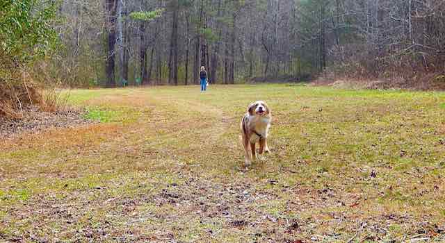 Amenities: Excellent parking lot, picnic areas and bench seats at various spots
Open Times: Usually dawn until dusk
Overall Dittmer-Watts Nature Trail Park Rating: 3 out of 5
- 5 of 5 = view at the destination, views during the hike, A or B trail conditions
- 4 of 5 = view at the destination, A, B or C trail conditions
- 3 of 5 = no spectacular views but interesting environment, A, B or C trail conditions
- 1 or 2 of 5 = not worthy of recognition
Trail Map: Click here for the official trail brochure.
About the Hike at Dittmer-Watts Nature Trail Park:
Pick up a trail map from the small box on the left side of the sign at the trailhead if you feel you need it. Please return it after your hike. Or print out this nice trail brochure
We prefer what we call the “outer loop” at this park – the dogs love it too! The “outer loop” consists of several named trails. So here we go! From the parking lot enter the trailhead – this is called “Dogwood Trail”.
In about 60 yards you will see three trail signs – Turn right on “Creekside Trail”. Follow this trail along with the – surprise – creek and pass by the first picnic area. This trail ends at a very nice field great for throwing a ball or Frisbee with your dog. As you enter the field you will notice “Dogwood Trail” empties into this field as well. Continue to the opposite end of the field and more trail signs.
Here, we take “Meadowside Trail” to the right. Follow this trail to the next open field and another picnic area. Continue straight, pass by the entrance to “Mountain Vista Trail” on the left.
Straight another 30 yards to another trail sign and enter “Huckleberry Trail”.
Just a few yards in, you see “Ridge Trail” and veer right. “Ridge Trail” is where you find 3 of the steep down and ups – be careful. You will stay on “Ridge Trail” for .6 miles passing by “Huckleberry”, “Red Maple”, and “Rhododendron Trail” on the left. “Ridge Trail will end at “Mountain Vista Trail” and another picnic area.
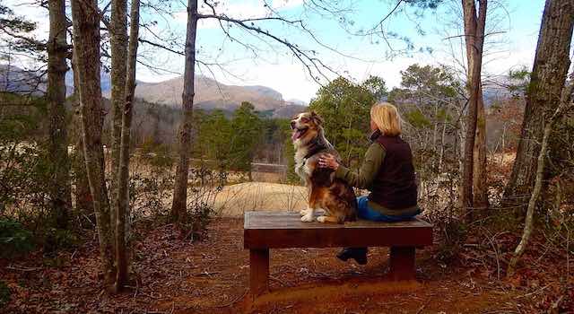
Now, we like to take a right on to “Mountain Vista” to see the nice view of the golf course and a nice view of Hickory Nut Gorge. There is a bench seat at the end of the trail so you can sit and enjoy the view. Oh! The fourth steep down and up is on this section of “Mountain Vista” – and you get to do it twice; because now you turn around and head back down “Mountain Vista” the way you came. Now we stay on “Mountain Vista” and pass the picnic area; head along the golf course and hit the “Rhododendron Trail” sign.
Turn right on “Rhododendron” and follow it to the first grassy field you came upon at the beginning of the hike. Now we are headed back to the parking lot.
Head to the opposite end of the field and onto “Creekside Trail”. Follow “Creekside” to “Dogwood” and hang a left. Bam, your back! The end of a great hike and one I know the doggies will love!
GPS Track Map and Elevation of Dittmer-Watts Nature Trail Park Hike:
For a complete GPS Tracking Map of our hike to Dittmer-Watts Nature Trail Park – CLICK HERE
We hope you and your furry friend enjoy your time at the Dittmer-Watts Nature Trail Park as much as we do. And remember … always, please keep the trails looking nice for future hikes.
Explore Our Other Detailed Hiking Trail Reviews:
Cedar Mountain Hiking
-
Dupont State Forest Waterfalls Hike – Cedar Mountain, NC
Banner Elk Hiking
-
Profile Trail Hike on Grandfather Mountain– Banner Elk, NC
Gerton Hiking
-
Bearwallow Mountain – Gerton, NC
-
Florence Nature Preserve – Gerton, NC
-
Little Bearwallow Falls – Gerton, NC
Lake Lure Hiking
-
Buffalo Creek Park – Lake Lure, NC
-
Chimney Rock Climbing Park – Lake Lure, NC
-
Party Rock – Lake Lure, NC
Old Fort Hiking
-
Catawba Falls – Old Fort, NC
Saluda Hiking
-
Big Bradley Falls – Saluda, NC
-
Little Bradley Falls – Saluda, NC
-
Pearson’s Falls – Saluda, NC



 14 Reasons to Love Lake Lure in Winter